A Little-Known Slice Of Minnesota History Can Be Found At This Roadside Lookout
By Trent Jonas|Published December 04, 2023
×
Trent Jonas
Author
Trent Jonas came to Minnesota to attend college - and never left. He's a Twin Cities-based writer with a BA in English and a MFA in creative writing, a Minnesota Master Naturalist, and the proud father of two adult children. With more than a decade of freelance writing experience under his belt, Trent is often out exploring his favorite topics: Minnesota's woods, lakes, and trails. Rhubarb pie is his weakness, so discovering new diners is also a passion.
When traveling Minnesota Hwy. 61 along the North Shore of Lake Superior, about five miles west of Grand Marais, you’ll encounter one of the tightest curves on this stretch of road. Just before the curve, however, you’ll see a pull-off with a panoramic vista out over Lake Superior. This is Good Harbor Bay Overlook – and there’s much more to this Minnesota roadside lookout than just a pretty view. If you take a moment to explore the wayside, you’ll learn how this view – and much of Minnesota’s most spectacular geography – came to be formed.
Just outside of Grand Marais, Minnesota, you'll find a wayside overlooking Good Harbor Bay on the North Shore of Lake Superior.
There was an incredible amount of volcanic activity, and lava spewed up from the rift, piling on top of itself. However, the rift was unsuccessful. The continent remained intact, but it now bears the scar - in the form of the Lake Superior basin and several other geologic features across the Midwest that remind us of this turbulent time in Minnesota's geologic history.
The Midcontinent Rift is responsible for the dramatic features we see along the North Shore and throughout the Arrowhead Region of Northeastern Minnesota.
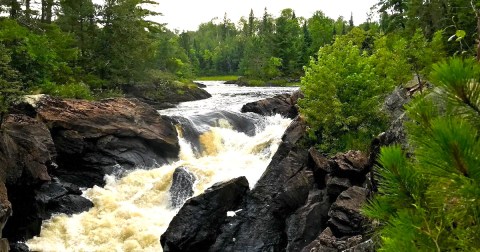
And if you've ever noticed a similarity between the Dalles Area of the St. Croix River near Taylors Falls and the Minnesota shoreline of Lake Superior, you are not wrong.
Interstate State Park, 307 Milltown Rd, Taylors Falls, MN 55084, USA
The area near Interstate State Park offers some of best examples of exposed rock from the Midcontinent Rift that can be found.
So next time you’re driving by Good Harbor Bay, be sure to pull over at this small overlook – you’ll learn a lot more than you’d ever expect to in a classroom with a spectacular view – I’ve been fascinated by the Midcontinent Rift ever since I first learned about it! I think it would make an awesome road trip to follow the path of the rift zone through Minnesota and look for places where the dramatic rocks from this period in Minnesota’s geologic history are exposed. Have you heard of the Midcontinent Rift or visited any of these sites? Let us know in the comments!
OnlyInYourState may earn compensation through affiliate links in this article. As an Amazon Associate, we earn from qualifying purchases.